
- 1. Starting point of 3D-Bridge
- 2. Administration and Organisation
- 3. Objectives of the Project
- 4. Visualisation of Cultural Heritage - Functional Description
- 5. International Conferences and Workshops, Dissemination and Publications
- 5.1. 3D-Bridge Conference, 10th – 11th November 2005, Jyväskylä, Finland
- 5.2.3D-Bridge Conference, 19th – 21st June 2006, Rome, Italy
- 5.3. Dissemination and publications
- Royal Holloway, University of London:
- Bibliotheca Hertziana:
- University of Jyväskylä, University museum
- Seinäjoki Polytechnic, School of Information and Technology
- Evakko-säätiö foundation
- 6.Evaluation
- 7.Summary and European Added Value
- 8. Budget
- 9. Future of 3D-Bridge
www-layout: Ari Häyrinen
Translation and language checking: BA Milla Wilkan
1. Starting point of 3D-Bridge
- Transferring of Cultural Heritage with New Technology
Digital visualisation and measuring technologies are part of the everyday life of information technology. How are we able to utilise these technologies in humanistic research and in the preservation of European cultural heritage? Answer to this question was sought in the 3D-Bridge – Transferring of Cultural Heritage with New Technology – project, in which five European cultural heritage target areas were introduced. In this event, technology and humanistic science encountered.
The basis of the 3D-Bridge – Transferring of Cultural Heritage with New Technology – project (later 3D-Bridge) was to preserve European cultural heritage, to study multi-perspective design practices and architecture, and to adapt them to practical building preservation. So far, the research of physical cultural heritage has, in most cases, utilised conventional study and presentation methods. However, the recent technological development and modelling of buildings of cultural heritage in different parts of Europe have proved the 3D technique a very practicable method of research and virtual mobility. The project aimed at developing new technological tools for the visualisation of cultural heritage. By applying new technologies, European cultural heritage is translated into the language of future societies and media literate generations.
3D-Bridge is a co-operation project which was implemented between 1st September 2005 and 31st August 2006. It was carried out with the support of the Culture 2000 programme of the European Union. Other co-funding organisations were the Regional Council of Central Finland, the Regional Council of South Ostrobothnia, the Regional Council of North Savo, and the Ministry of Education.
The most significant result of 3D-Bridge can be considered to be the participants’ shared experience, which originated in collaboration, that European culture has a common, classical core, which extends through different eras and stylistic periods to the present despite national and religious borders.
top2. Administration and Organisation
The project was co-ordinated by the University of Jyväskylä, Finland. The general administration of the project was in Jyväskylä University Museum which had the responsibility of the lead partner. The Vice Dean of the Faculty of Humanities, Professor Heikki Hanka acted as the Head of Project. Co-ordinator / researcher, Master of Arts Helena Lonkila was responsible for the day to day running of the administration of the overall project. Project secretary, MBA Minna Kosonen managed the economical matters and practical administrative tasks.
Co-organisations were
- Royal Holloway, University of London, the United Kingdom
- Bibliotheca Hertziana, Rome, Italy
- Seinäjoki University of Applied Sciences, (former Seinäjoki Polytechnic) Seinäjoki, Finland
- Evakko Säätiö Foundation, Iisalmi, Finland
The project had an international steering group whose role was to support the project’s implementation: to steer and monitor the project so that it was carried out according to the accepted project planning and budget, decide on the changes of the project’s budget and survey the final report compiled by the co-ordinator. All co-organisers and the national funders (Regional Councils) were given the opportunity to name a representative. The members were:
Organisers:
- Bibliotheca Hertziana, Max Planck Institute for Art History, Dr. Hermann Schlimme
- Royal Holloway, University of London, Dr. Jari Pakkanen
- Jyväskylä University Museum, Director, Dr. Janne Vilkuna, Senior Curator Pirjo Vuorinen
- Evakko Säätiö Foundation, Iisalmi, Father Elias Huurinainen
- Seinäjoki University of Applied Sciences (former Seinäjoki Polytechnic), School of Information and Communication Technology and School of Culture and Design, Building Conservation, Training Programme Manager Matti Laine, Vice Laboratory Engineer Outi Orhanen and Manager of International Affairs Helli Kitinoja
- University of Jyväskylä, Department of Art and Culture, Co-ordinator Tellervo Helin
National funders:
- Regional Council of South Ostrobothnia, Cultural Manager Marjatta Eväsoja
- Regional Council of Central Finland, Director of Planning and Development Hannu Korhonen
- Regional Council of North Savo, Director of Development Simo Kotiluoto
The steering group gathered twice during the project: at the launching conference on 11th November 2005 in Jyväskylä and at the conference in Rome on 20th June 2006. The duties of the project’s steering group were:
- to operate as support to the project leader
- to steer the project so that it fulfilled the accepted application form
- to follow that the objectives of the project were achieved
- to follow the realisation of the project’s cost estimate and financial plan
- to consider the possible needs for changes before sending change requests to funders (for example the implementation time or changes in the content or in the cost estimate)
- to consider the project’s final report
Follow-up meeting of the steering group was arranged on the Internet in week 41, in 2006. The Final Report including Final Financial Accounts Form and Technical Implementation Report was accepted by the resolution of the follow-up meeting.
top3. Objectives of the Project
The first objective of the project was to develop new tools for the research and preservation of European cultural heritage. This goal was achieved by the visualisation of target areas. In practice, the work proceeded as follows:
- Documentation of five different target areas in digital format, for example photographs, written documents, location co-ordinates, drawings, archaeological data, archive material.
- Software development, which included the planning of a Virtual Research Environment (later VRE) and database, and the creation of an application. The application was linked on the Internet and can be used by means of a web browser.
- Entering the data into a database.
- Three-dimensional (later 3D) modelling, documentation of the activities in VRE.
The second objective of the project was to bring together cultural heritages of the target areas which differ from each other by their geographical, ecological and cultural characteristics. This took place in interaction through VRE during the visualisation. VRE is the project participants’ common web environment, which was used for mutual interaction. The interaction covered the exchange of data and experience, discussion on the issues of data collection and argumentation, as well as evaluation of the functioning and development of VRE.
The third objective of the project was to transfer European cultural heritage values and cultural heritage literacy into the language of future societies and generations. This goal was achieved by:
- Using open source environments available to all Europeans.
- Making the 3D models available in teaching and learning, tourism and production of cultural contents, among other things.
- Ensuring the preservation of cultural heritage in digital format by using open source environments.
The target of 3D-Bridge in a nutshell:
- To develop tools of new technology based on an open source policy for the research and preservation of cultural heritage.
- To highlight the common European contents of regional cultural heritage research based on different geographical, ecological and cultural starting points.
- To translate European cultural heritage into the language of future societies and media literate generations.
4. Visualisation of Cultural Heritage - Functional Description
In this chapter, all the five subprojects describe their own work in more detail. The texts in this chapter have not been edited, but the writers approach the process freely from their own viewpoint and from that of their community. Thus, the aim is to highlight the polyphony produced by the various participants and methods, and to emphasise the various levels and productivity of cultural interaction that originated in the project.
top4.1. Visualisation of Seminaarinmäki Campus
Researcher Ari Häyrinen and Senior Curator Pirjo Vuorinen
Responsible co-organisation:Jyväskylä University Museum
Seminaarinkatu 15,
40100 Jyväskylä
Finland
Contact person/project manager:
Name: Pirjo Vuorinen
Address: Jyväskylä University Museum, Seminaarinkatu 15, 40100 Jyväskylä, Finland
Email: pirjo.vuorinen_place_at-sign here_jyu.fi
Tel. +358 14 260 3800
top
Starting point and Themes
The University of Jyväskylä is connected with the development process of European vernacular education in a cultural-historical way. The University of Jyväskylä was the first Finnish-language teacher training college, having corresponding institutions e.g. in Germany and Switzerland as its models.
Seminaarinmäki (Seminaari Hill) Campus project focused on developing a documentation model for a cultural-historical area. We found out what kind of architectural and social milieu Seminaarinmäki used to be in the 1920’s -1930's and how the area has changed. In order to do that, we needed a tool that would allow different types of views to the core material and could be used for work with interactive 3D models.
The problem is that information databases used in cultural-historical areas are very limited in this sense and they do not provide any support for research or group work. The second problem is that traditional database design creates databases that are suitable for saving exact data. However, when we have information that is not exact, it is difficult to place it in the system. Therefore, we had to develop a novel way of storing and handling cultural-historical data.
topThe objective
The aim of our subproject was to develop a new type of documentation method for cultural-historical reconstruction. By combining database approach with hyperlinking and virtual reality application, it was possible to develop a tool that supports group work and is flexible enough for storing different types of documentation. The area of Seminaarinmäki was used as a test case for the documentation model. We gathered new information about the area by modelling its buildings and storing metadata to the database.
We also examined using open source software throughout every stage of the process. Software development and 3D modelling were made with free, open source software. It guaranteed that methods and tools for a similar process are available to anyone. The software developed in the project was released under a free GPL license.
topMain Activities
- The material for the 3D modelling was gathered. The plans and images of the buildings were scanned.
- The currently vanished 15 buildings were modelled.
- The alpha version of the database application was developed and it has been in test use.
We developed a new method for cultural-historical documentation. We also developed and documented a fully open source method for virtual reconstruction with 3D models. The concrete results of these actions are:
- IDA database open source software (alpha version)
- the documented 3D model of the Seminaarinmäki area
- documentation of the production of the 3D modelling process with open source software
- IDA3D, the 3D client open source software for real-time presentation (pre-alpha version).
IDA combines database structure and hyperlinking in order to produce a multi-perspective and polyphonic information system that allows an unlimited number of different types of views to the protected core data. The system has no predefined data structure for targets. This means that every organisation is free to define what kind of information they want so store.
IDA has a unique tool called arguments for allowing multiple views to the core material. Arguments are html-documents with text and links to the database material. Arguments belong to the project and are therefore organised by projects. Arguments are constructed with a built-in WYSIWYG editor. It is possible to use any item from the database in an argument through IDA's link board. When an item is picked from the link board to the argument, it is actually linked to it. By following the link in the argument, it is always possible to find the original data. Links in IDA are always bidirectional, so every item also "knows" when it has been used in the argument, and the link back to the argument is shown among the item's other information.
From the accessibility perspective IDA's arguments are one way to approach material instead of traditional queries. Queries can be problematic for the general public because their efficient usage requires knowledge of databases in general, and some information about the content of the database is needed. Projects create a new analysis of the material, but at the same time, a new user interface is created. One might say that every project in IDA is a mini-exhibition, which has a unique perspective to the material.
The 3D model consists of 15 currently vanished buildings and 10 existing buildings. The vanished buildings were modelled in detail and the rest were modelled only by their main features. This fulfils the requirements of the original plan.
Our aim was to develop a fully open sourced tool chain that could be used for cultural-historical reconstruction. This approach included documentation of the whole process, so that our experiences would benefit other organisations as well.
- - tutorial: using Inkscape and Blender for modelling: http://www.arthis.jyu.fi/ida/inkscape.php
- - short tutorial: How to set up OpenSceneGraph real-time rendering library: http://www.arthis.jyu.fi/ida/compile.php
- - short tutorial: How to export 3D models from Blender to OpenSceneGraph format: http://www.arthis.jyu.fi/ida/bosgexp.php
- - tutorial: How to construct complex scenegraph from Blender models: http://www.arthis.jyu.fi/ida/scenegraph.php
- - preliminary documentation of IDA and IDA3D: http://www.arthis.jyu.fi/ida/idainfo.php
Utilisation of the Results
The model of the Seminaarinmäki area is presented as a virtual reality application in the museum's next permanent exhibition. Visitors are able to examine the area and all metadata that is assigned to the model. There are two special groups of visitors that benefit from it more than others: architecture students and elementary school pupils. For the students the metadata of the area is important in order for them to understand the special nature of the area. For the pupils this will offer an interesting way to immerse themselves in history, and for their teachers the model is way to transfer cultural heritage.
The IDA will be used as a research tool that allows students and researchers to work with the data stored in the system and make their notations on it.
topStaff
Name: Pirjo Vuorinen
Task: Contact person
Sphere of
responsibilities (main): Scientific concept of
case study
Name: Ari Häyrinen
Task: Researcher
Sphere of
responsibilities (main): Scientific concept of
case study / software development/ coordination of the modelling
Name: Saana Tammisto
Task: 3D modelling
Sphere of
responsibilities (main): Reconstruction
top
4.2. Visualisation of Filippo Juvarra's Palace and Garden Plan
Responsible co-organisation:
Bibliotheca Hertziana
Max Planck Institute for Art History
Via Gregoriana 28
I-00187 Rome, Italy
Contact person/project manager
Name: Dr. Hermann Schlimme
Address: Bibliotheca Hertziana
Max Planck Institute for Art History
Via Gregoriana 28
I-00187 Rome, Italy
Email: schlimme_place_at-sign_here_biblhertz.it
Starting point and Themes
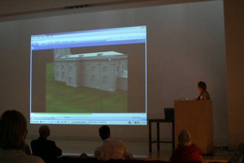
The case study examined the role of architectural drawing in the architectural planning process of the late seventeenth and eighteenth century. The use of three-dimensional drawings (CAD models) and interactive animations is now an essential prerequisite to understand and critically visualise the spatial conception inherent in the drawings and sketches of the period. Bird’s eye perspectives, the control of visual axes with the help of sketches, or the checking of how the layout of a villa or a country house is perceived from a moving object, such as a travelling coach, are just some examples of how – as in Filippo Juvarra – a multi-perspective planning process dissolved the central perspective of the Renaissance and came close to the new perception of space in natural philosophy.
This perception of space was characterised by dynamic alterations in perspective. It can now be reconstructed in its full range with present-day imaging techniques and 3D visualisation. In particular, 3D reconstruction shows what spatial questions were posed and solved in the drawings or where a drawing remained two-dimensional. In a pilot and feasibility study Hermann Schlimme, using the resources of CAD, has spatially visualised Juvarra’s design for a church dating back to 1707, which was produced as an academic project and was never intended to be executed. The study has succeeded in elucidating aspects of Juvarra’s spatial thinking and in documenting the peculiarities of his “paper” architecture.
The objective
For 3D-Bridge we produced, in a CAD model, a 3D visualisation of the design for a palace layout with a park for three persons of the same royal rank, with which Juvarra won the Clementino Competition of the Roman Academy in 1705. On the basis of this project, Juvarra developed his design method and transmitted it to the students at the Academy. Indeed, the plan was placed on display for centuries in the Roman Academy and, in this way, it became a model for generations of European architects who were sent to Rome to complete their education. The wooden model, commissioned by Juvarra for the partially realised palace project in Rivoli, in the environs of Turin, is cited as a comparison. To understand the design methods of the exceptionally influential Juvarra has long been a desideratum of art history. 3D technology now creates the basis for it. The model itself (download together with the Unreal Engine Environment), the description of approach and research findings (pdf-download) and the CAD-construction records are accessible password-free on the web-page of the Hertziana case-study
(http://wissensgeschichte.biblhertz.it/3d-bridge-html/ ).
Main Activities
- The original material for the 3D modelling was gathered (especially drawings in Rome), scans were made of the drawings of Juvarra using the highest resolution (250 MegaPixel resp. 750 MB per scan), so that the mapping of model surfaces with respective parts of the drawing leads to very convincing results. The planned travelling to Madrid and Vincennes was omitted, because the documentation of material proved to be possible by mail. Travelling to Turin (architectural model documentation) was omitted because the model resulted to be in fly cases. A photographic documentation and survey drawings were available from Turin.
- Modelling of the 1705 palace project and garden plan of Juvarra was completed in August. It prooved to be difficult to recruit a CAD-Specialist. Instead of January the Hertziana could employ him only in February, which caused some delay to the work schedule. Therefore it prooved necessary to outsource some of the modelling/texturing work in order to fulfil the aim of the 3d-bridge. All modelling/texturing was made with Maya, the web presentation of the model uses the Unreal-Engine-Technology, which offers an intuitive way of exploring the model on the screen and through the web. In parallel to the modelling, the scientific value of the model was developed, first results presented at the Rome conference in June.
The wooden model commissioned by Juvarra for the partially realized palace project in Rivoli is cited as a comparison. The modelling was made correspondingly brief. After correpondence with Turin, modelling was performed on the base of existing photographs and survey drawings.
-
The online publication of the Hertziana case study was completed and comprises the models and describing texts (see above for web-address). Links from and to Lineamenta (database for the study of architectural drawings) were established. The general organisation of the web page containing all the data was outsourced.
Concrete results and the estimated effectiveness/impressiveness of the results
The concrete result is a complex and mapped model of the 1705 Juvarra palace project, which has the estimated effectiveness and impressiveness. The use of unreal tournament technology underlines this effectiveness. The plans are thus fulfilled. Furthermore, there is – as planned – a simple visualisation of the wooden Rivoli model.
Utilisation of the Results
The models will be used within the larger framework of “Lineamenta - a database for the study of architectural drawings” (with partner institutions in Germany and Italy) and within the research programme ”Epistemic History of Architecture” (Partner is the Max Planck Institute for the History of Science in Berlin), where, among other things, the design knowledge of architects is investigated. The results of Hertziana’s contribution to 3D-Bridge generally show the importance that CAD tools and technology should have in the research of art history and history of architecture.
Staff
Name: Elisabeth Kieven
Task: Head
Sphere of responsibilities (main): Scientific concept of case study
Name: Hermann Schlimme
Task: Project manager / scientific coordinator
Sphere of responsibilities (main): Scientific concept of case study / feasibility study (3D modelling and
animation) / coordination of the project / supervision of staff
Name: Günter Eger
Task: Modelling
Sphere of responsibilities (main): 3D modelling / animation / web presentation of models
4.3. Visualisation of Rome's Maritime Facade
Responsible co-organisation:
Royal Holloway, University of London
Contact person/project manager
Name: Jari Pakkanen
Address: Department of Classics
Email: j.pakkanen_place_at-sign_here_rhul.ac.uk
Starting point and Themes
The 3D-Bridge subproject is an integral part of the larger research project The evolution of Rome's maritime facade: archaeology & geomorphology at Castelporziano conducted by the Department of Classics, Royal Holloway, University of London (later RHUL). The presidential estate of Castelporziano/Capocotta starts 7 kilometres south of the Tiber mouth at Ostia and includes the next 7 kilometres of coast, free from 20th century development, though heavily forested. Behind the modern beach lies a sequence of earlier sandy coastlines and dune systems, in the midst of which, between 400 and 800 metres inland, is an almost continuous line of Roman ruins, partly visible above ground, partly buried in sand: the remains of a substantial tract of the ancient Laurentine shore. The project focuses on the Roman period (100BC-AD500), when the shore became the favoured ‘resort’ of the Roman aristocracy, and host to a large community of maritime villas.
The 3D-Bridge subproject aimed to take a short stretch of this coastline under closer scrutiny and build a three-dimensional model that can be used to explore and explain how the villa architecture responded to the continuing evolution of the coastline and to the environmental changes associated with this development. The principal targets of the archaeological fieldwork seasons in September 2005 and April 2006 were to obtain the extent, composition and phasing of the architecture on the chosen site by combining low forest clearance and gridded surface debris analysis with geophysical surveys, high-precision topographic survey (differential global positioning system and total station) and excavation of test trenches. A pilot scheme in 2002–4 successfully tested a new methodology under the local forest conditions (which hamper the use of remotely sensed images). The new data was analysed, entered in a GIS database and integrated with elements from the older paper archive for further analysis together with the geomorphological and environmental data.
The objective
Integration and dissemination of archaeological, architectural and geomorphological data from Castelporziano in digital format.
Main Activities
-
Archaeological and geomorphological fieldwork
in the project plan Sept. 2005 was reserved for fieldwork, but as implemented it was necessary to divide the work into two separate phases in Sept. 2005 and Apr. 2006
18/9–1/10/2005: Jari Pakkanen & Emma Claridge; fieldwork carried out 21–30/9 concentrating on recording surface features (archaeological and geomorphological)
4–26/4/2006: Amanda Claridge, Jari Pakkanen, Peter Rose, Timothy Evans, Floriana Policastro, and Tom Haddow; fieldwork carried out 5–22/4, recording of surface features (archaeological and geomorphological), geophysical surveys, archaeological test trenches
work on the current surface features was conducted as planned, but no new geomorphological coring was carried out because the project partners at Loughborough University had no suitable applicants to the two PhD studentships needed for carrying out fieldwork and analysis; this part of the project will start in autumn 2006 with existing AHRC funding
however, the reduction of the amount of funds needed on the analysis of the geomorphological coring samples resulted in a positive change in better integrating the work of the subproject into the whole 3D-Bridge project: the freed funds were used to strengthen the modelling side of the Castelporziano project by employing Dr. Peter Rose (see below 4) -
Analysis of the archaeological data and entering into a GIS database
carried out as planned by J.P. in Oct. 2005–Jan. 2006, and new archaeological data from the fieldwork added in April–June 2006 by J.P. and P.R. -
Initial analysis of the geomorphological data and entering into a GIS database
existing geomorphological data entered as planned by J.P. in Oct. 2005–Jan. 2006, and new collected data on the surface features added in April 2006 by J.P. and P.R. -
Modelling the coastline and architecture based on the archaeological and geomorphological data
carried out as planned by J.P. in Feb.–June 2006 and P.R. in March–June 2006
due to also employing P.R. for modelling, the results of the modelling will be far more extensive than originally planned, and his participation will also make it possible to test the use of photogrammetry as part of the villa modelling at Castelporziano
- The concrete results of the project include a three-dimensional digital elevation model (DEM) of the surface features of the target area related to the ancient coastline. The model now extends from the Villa del Confine to the eastern edge of the Vicus Augustanus. From south to north the survey stretches from the series of densely forested dunes to the Via del Telephono, covering a total area of c. 600 x 150 m (c. 90,000 square metres). A total of 11,500 measurements were taken. The principal aim of the survey project was fully reached. The model maps both the archaeological and natural features of the area, and it can be used to explore and explain how the architecture of the Roman villas, the associated vicus and possible harbour responded to the continuing evolution of the coastline and to the environmental changes associated with this development. The DEM of the surface features, previous and newly collected archaeological material and architectural reconstructions are now integrated as part of the GIS database. The database has already proved to be an important tool for the management of the archaeological heritage and for the protection of the natural environment at Castelporziano/Capocotta. The Internet-accessibility of the GIS was implemented at the end of the main project by the Archaeological Data Service as planned. Since it was also possible to get Dr. Peter Rose to take part in the modelling, the results of the modelling of the architecture are far more extensive than originally planned, and his participation also made it possible to test the use of photogrammetry as part of the project (P.R.’s recently completed PhD dissertation utilises photogrammetry to model the standing Roman buildings at nearby Ostia).
- A website for the project has also been implemented by P.R (www.rhul.ac.uk/classics/), and a link to these pages established from the Castelporziano website. The publication of the work will be included in the Castelporziano scholarly series (a draft of the chapter completed during the project).
- There is a regular programme of organised tours for schoolchildren and other group visits, and both an archaeological and a natural history museum have been set up on site. Discussions of how to best incorporate the visual information produced by the project are ongoing, and they will make a major contribution to the quality of visitor experience and to public understanding of the past and present dynamics of environmental change.
- The project has enhanced and created contacts between co-organisers from different parts of Europe, thus facilitating uniting and sharing cultural and technical information. This has contributed towards developing cultural diversity and understanding of our common historical background both in the UK and other co-organising nations.
- The project has provided a model example of how archaeological, architectural and geomorphological data can be integrated and disseminated in digital format (www.rhul.ac.uk/classics/).
Utilisation of the Results
-
The results will be utilised in several different ways in the future:
the DEM has already to date highlighted several areas which require further investigation by other means, such as further test trenches, geophysical survey and geomorphological coring. The covered area can also act as test case for deriving a more extensive though less precise elevation model of the rest of the ancient coast line from satellite images - the project results will be fully integrated into the larger overall project The evolution of Rome's maritime facade: archaeology & geomorphology at Castelporziano and will form an integral part of further analyses of the site
- the produced archaeological information and reconstructions are currently used for the project website (www.rhul.ac.uk/classics/), but, in the future, they will form one core element of the planned Castelporziano visitor centre: the area is part of the estate of the President of Italy and therefore very largely closed to the wider public, but the plans related to the new visitor centre include opening parts of the area to the public. In the meantime, disseminating information about the archaeological importance of the target area is best done via websites
Staff
Name: Jari Pakkanen
Task: Project manager, researcher
Sphere of responsibilities (main): Archaeological research, modelling
Name: Amanda Claridge
Task: Director of the AHRC-funded project on Castelporziano
Sphere of responsibilities (main): Archaeological research
Name: Peter Rose
Task: Project researcher
Sphere of responsibilities (main): Archaeological research, modelling
Name: Timothy Evans
Task: Researcher
Sphere of responsibilities (main): Geophysical survey, excavation
Name: Floriana Policastro
Task: Fieldwork assistant
Sphere of responsibilities (main): Archaeological excavation work
Name: Emma Claridge
Task: Fieldwork assistant
Sphere of responsibilities (main): Recording surface features
Name: Tom Haddow
Task: Student volunteer
Sphere of responsibilities (main): Fieldwork assistance
4.4. Visualisation of St. Trinitatis church, Liepaja, Latvia
Responsible co-organisations:
Seinäjoki University of Applied Sciences (former Seinäjoki Polytechnic), School of Information and Communication Technology (ICT) and School of Culture and Design, Building Conservation
Contact person/project manager:
Name: Helli Kitinoja
Address: Seinäjoki University of Applied Sciences, P.O. Box 412, 60101 Seinäjoki
Email: helli.kitinoja_place_at-sign_here_seamk.fi
Starting point
Seinäjoki University of Applied Sciences has participated in two projects of conservation and documentation of the St. Trinitatis church in Liepaja, Latvia during years 2002 - 2004 and 2004 - 2005. These projects were funded by the European Commission’s Leonardo da Vinci programme and objectives were, among other things, to create documentation and to make conservation work in the church, and also to start the 3D modelling of the building.
St. Trinitatis church is a remarkable example of two significant styles. External facades are Late Baroque and the interior is well-preserved Rococo. One important part of the church are the world’s largest mechanical organs, which are still in use.
Themes
Themes for the 3D-Bridge project were to
- model the skeletal structure of the building in a 3D form and create an observation system for the potential settling of the structures
- create a concept which can be utilised in damage investigation and observation of other valuable buildings
- study the opportunities of presenting large objectives in a virtual reality Cave
The objective
Objectives of the project were to
- create a 3D model of St. Trinitatis Church in Liepaja, Latvia
- create an observation system for the observation and visualisation of settling of the church pillars and to study the possibilities to use this pilot observation system in other valuable buildings of cultural heritage
- develop the 3D modelling know-how and to get acquainted with a new 3D modelling technology
experiment the usage of virtual reality Cave in a visualisation of a large 3D model
Main Activities compared to the actions and timetables presented in the project plan
September – December 2005
The project started by planning the 3D modelling work. The first step in 3D modelling was to make measurements for the model. This meant that we needed accurate measures from both the interior and the exterior of the building. When the 3D-Bridge project was outlined, we had figured that all these measurements would have been done with a tachymeter. When the project started, we had received quite promising examples of laser scanner measurements. Laser scanner is a device that measures tens of thousands of 3D points – or vertices – per second to create a point cloud of the target object. With this alteration we could achieve more measurements in a shorter time and with less work. A budget change was necessary for this, because we had planned the work to be done in a different way. The measurement points needed for calculating the settling of the columns was done with a tachymeter, since it is very precise and the measurement accuracy is not dependent of different surface materials and colours like it is in the case of laser scanning.
We found a suitable company to carry out the laser scanning task after competitive bidding. The work was purchased from the Finnish Road Enterprise (Tieliikelaitos) and the measurement trip took place between the 13th and 20th of November 2005. Only one trip was needed instead of two trips previously planned to take place between the 5th and 9th of September and between the 10th and 12th of December 2005. The measurement trip was made by car because of the needed equipment. Participants were Jarmo Jokikokko, Finnish Road Enterprise and Outi Orhanen, Seinäjoki University of Applied Sciences, and the measurements were taken in 5 days. During the autumn, all existing documentation material was searched through and groundwork for the actual 3D model was done.
January – April
When the measurement material was received, we started post-processing the point cloud material. The next step would have been to triangulate the vast 3D point cloud material – tens of millions of 3D points – to form 3D surfaces called meshes. It turned out that none of the software packages available were capable of handling these huge amounts of 3D points, even though the material was sliced into 31 pieces – 23 files from the interior and 8 files from the exterior of the church. In total, there was 2.5 Gigabytes of data in AutoCAD 2000 DWG format, 5 Gigabytes in ASCII format. To solve this problem a survey of suitable commercial and open source software solutions was done. We found out that there were no open source software available for the triangulation of the point vertices, and commercial software packages were too expensive. Bearing in mind the schedule of the project, we decided that by implementing a code of our own using different Delaunay triangulation algorithms available, the project would not get done in time. Finally we found very efficient commercial software with fairly low costs. Rental of the software and purchasing education for using it were not included in our project plan and we needed to apply for a budget change once more. Simultaneously with modelling work, we tried to find the best way to demonstrate the settling of the church.
May – August
3D modelling work continued with the following tasks
- triangulation of the point cloud to a 3D mesh
- reduction of the 3D mesh by removing unnecessary vertices and polygons/triangles
- creation of the textures
- application of the textures
- testing the model in the Cave environment, and possible iteration between stages 2 to 5
- creation of the visualisation information for the settling of the control points.
More photos were taken of the church during the visit to Liepaja, Latvia. These photos were the ones to create the texture images from. The original photographs were shot in order to show the details of the renovation project, and thus they are not fit for texture images. The images for the textures should cover larger areas, such as one whole wall in one photograph.
Control measurements for the settlements of the church were done. These control measurements were done with a tachymeter, not a laser scanner. Only the control points attached to the pillars and other solid structures of the church were measured.
Concrete results and the estimated effectiveness/impressiveness of the results
- As results of this project, a 3D model of the St. Trinitatis Church and a simple visualisation method, to illustrate the settlements of the columns and other structures of the church, were created.
- During the modelling project, co-operation with old and familiar partners has strengthened. The project has also acquainted us with other project partners and, thus, cultural diversity and similarity have been shown.
- This project and its results give an example of and ideas to the preservation of cultural heritage in Southern Ostrobothnia, Finland.
- In Latvia, the project has given opportunity for the St. Trinitatis Church, the Evangelical-Lutheran Consistory of Latvia and the City of Liepaja to become internationally better known. The model and the observation system also create a tool for St. Trinitatis Church to continue restoration work in the church.
- The 3D model of St. Trinitatis church serves as a model example of digital presentation of European cultural heritage preservation.
Utilisation of the Results
Seinäjoki University of Applied Sciences may utilise the results of this project and experience of the 3D modelling of a large building in further 3D modelling work and education. Also in the field of conservation education, the observation system and the 3D model of St. Trinitatis Church can be utilised as an example of documentation.
Local and regional partners can use the whole project and its results to increase awareness of cultural heritage and emphasise the importance of taking care of this heritage.
International partners in Latvia may use the results to increase tourism. This project and its results can also be used as an example in Latvia to increase awareness of cultural heritage and to emphasise the importance of taking care of this heritage. In St. Trinitatis Church, the observation system may be used to observe the settling in the future.
top
Staff
Name: Helli Kitinoja
Task: Modelling assistant
Sphere of responsibilities (main):
Name: Essi Korkiakoski
Task: Modelling assistant
Sphere of responsibilities (main):
Name: Tapio Hellman
Task: Modelling
Sphere of responsibilities (main): 3 D model and observation system
Name: Jouko Pakkala
Task: Modelling
Sphere of responsibilities (main): 3 D model and observation system
Name: Jari Rajamäki
Task: Modelling
Sphere of responsibilities (main): 3 D model and observation system
Name: Outi Orhanen
Task: Modelling
Sphere of responsibilities (main): Measurements and observation system
Name: Matti Laine
Task: Modelling
Sphere of responsibilities (main): Measurements and observation system
top
4.5. Visualisation of Churches, Chapels and Monasteries in Karelia
Responsible co-organisation:
Evakko Säätiö Foundation
Contact person/project manager:
Name: Elias Huurinainen, Chairman of Foundation
Address: Kirkkopuistonkatu 28, 74100 Iisalmi, Finland
Email: elias_place_at-sign_here_ort.fi
Starting point and Themes
Evakko Säätiö has studied orthodox churches and tsasounas (chapels) in Karelia for 17 years. As one of the central themes, Evakko Säätiö has emphasised the Karelian cultural history and its application in present-day cultural tourism. The starting point was, with the help of university and research institute collaboration, to productise a significant and pioneering cultural entity in Evakkokeskus, which would become a significant cultural travel destination in Finland, as well as more widely in Europe.
The objective
The objective of the project was, with the help of information technology, to reconstruct the interiors of churches, which have been in the area of Valamo, Konevitsa, Lintula and Petsamo monasteries, and the architectural face of the area as it was in 1939. The illustration of the results was realised as virtual reality, multimedia, and 3D modelling, in which you move in the past, in the already mainly lost cultural milieu of the orthodox churches and monasteries of Karelia and Petsamo.
Main Activities
During the early stage of the project, the project material was compiled. It was mainly compiled from three archives: the archives of the Finnish Orthodox Church, Finnish Orthodox Church museum, and Valamo Monastery in Heinävesi. In February 2006, we travelled to Valamo, in Laatokka, to photograph it for two days. During the trip, the buildings of the main monastery on the island of Valamo were photographed in outline, and the so-called inner square buildings and churches were photographed in detail. The research subject on the island of Valamo is immeasurable. Therefore, we concentrated on the documentation of the so-called inner square. The documentation of Salmi Church in Salmi took place in June 2006. The above-mentioned archives concerning the Salmi Church have been re-photographed and copied.
Concrete results and the estimated effectiveness/impressiveness of the results
We have created an application for 3D modelling with our collaborative partner, Done Information Ltd. The application offers tools for achieving our goal, which means creating a 3D modelling of the Main Church of Valamo Monastery and of the surrounding buildings. (Budget changes due to this have been presented in chapter 8, annex 1.)
Utilisation of the Results
The tools of 3D modelling we have created benefit us so that, in the future, we can model all the other Karelian churches and chapels when applicable. Our collaborative partners can utilise the 3D modelling tools in their own projects. The tools can be applied in the modelling of buildings in many respects.
top
Staff
Name: Elias HuurinainenTask: Manager
Sphere of responsibilities (main): Research, innovation
Name: Tiina Komulainen
Task: Secretary
Sphere of responsibilities (main): Financial Administration
Name: Marko Anttonen
Task: Expert
Sphere of responsibilities (main): Implementation
top
5. International Conferences and Workshops, Dissemination and Publications
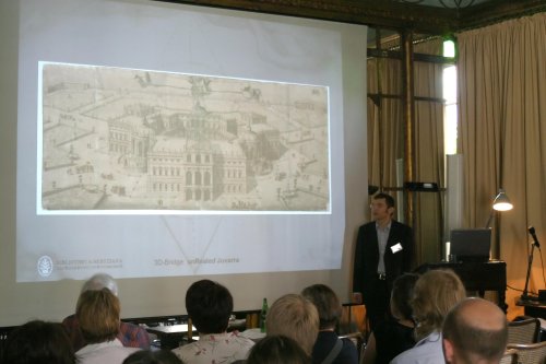
top5.1. 3D-Bridge Conference, 10th – 11th November 2005, Jyväskylä, Finland
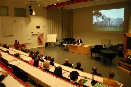
The 3D-Bridge – Transferring of Cultural Heritage with New Technology – conference was held at the University of Jyväskylä on the 10th - 11th of November 2005. It gave perspective to the starting points of the visualisation of cultural heritage and to the used technologies in five European target areas. The programme comprised of two theme days open to the public, on the first of which the starting points of 3D visualisations were observed from the viewpoints of archaeology, art history, building conservation, cultural environment education and tourism.
The theme of the second day was the technologies used in the different projects and the questions concerning their application. The programme included tours in the Agora Human Technology Centre and Virtual Laboratory Avec of the University of Jyväskylä, in Alvar Aalto Museum and in the Church of Petäjävesi, as well as a guided tour at the campus.
The lecturers of the conference were mainly experts of the 3D-Bridge – Transferring of Cultural Heritage with New Technology – project who works in different parts of Europe; in universities, research institutes, polytechnic universities, foundations and enterprises. Head of the Project, Professor Heikki Hanka (University of Jyväskylä) gave a lecture on the goal and contents of the project. Dr. Hermann Schlimme’s (Bibliotheca Hertziana) topic was Filippo Juvarra’s palace and garden plan. Dr. Jari Pakkanen and Ms. Amanda Claridge (Royal Holloway, University of London) spoke about 3D visualisation being a part of the research of archaeological excavations at Villa Castelporziano. Mr. Matti Laine and Mr. Jouko Pakkala (Seamk) presented the modelling project of the Liepaja Trinitatis Church building construction. Father Elias Huurinainen and Mr. Marko Anttonen (Evakko Säätiö Foundation) spoke about the visualisation of the interior of Valamo Monastery Church, and Senior Curator of the Jyväskylä University Museum Pirjo Vuorinen and researcher Ari Häyrinen discussed the starting points of the modelling project of old Seminaarinmäki campus at the University of Jyväskylä.
In addition, a Finnish modelling target area in Italy was presented. Principal Lecturer in 3D visualisation, (EVTEK Institute of Art and Design) Pasi Kaarto lectured on the 3D documentation of the house of Marcus Lucretius in Pompei. The language of the conference was English. The programme, abstracts and video recordings are available on the project’s website: http://www.arthis.jyu.fi/bridge/jkl.php. The conference was attended by 166 participants from 4 countries.
top
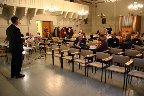
5.2.3D-Bridge Conference, 19th – 21st June 2006, Rome, Italy
Another 3D-Bridge – Transferring of Cultural Heritage with New Technology – conference was held on the 19th – 21st of June 2006 in Rome, Italy. In the centre of the three-day conference were the project’s modellings and their use as research tools. In the conference, in addition to the project’s experts, the floor was given to the representative of the British School, Dr. Susan Russell, to Dr. Maria Giuseppina Lauro of Segretariato Presidenza della Repubblica and to the Director of the Finnish Institute in Rome (Villa Lante), professor Mika Kajava. Additionally, the representative of Bibliotheca Hertziana, Professor Dr. Elisabeth Kieven welcomed the participants of the conference in Rome, and the museology professor of the University of Jyväskylä, Janne Vilkuna, held a presentation on items’ museum value.
On the first day (at the British School) the researchers of the project Dr. Hermann Schlimme, Dr. Jari Pakkanen, Ms. Amanda Clarige, Laboratory Engineer Outi Orhanen, Father Elias Huurinainen, and Senior Curator Pirjo Vuorinen observed the special characteristics of the research subjects created with the help of 3D visualisation, the phrasing of questions and the requirements of scientific argumentation used in connection with modelling. In addition, a modelling project outside this project was on view as Juhana Heikonen presented 4D reconstructing the area of Lacus Iuturnae. On the second day, the public lectures dealt with the practical technical implementation of the project’s current modelling, as the people responsible for the modelling, Mr. Günter Eger, Prof. Elisabeth Kieven, Dr. Peter Rose, Dr. Jari Pakkanen, Mr. Tapio Hellman (Seamk), Mr. Marko Anttonen and Mr. Ari Häyrinen spoke about the special characteristics of their own projects. Work groups discussed the different sectors of scientific modelling and project work.

The third day (The Finnish Institute in Rome) had been reserved for the evaluation of the project and the excursion in Castelporziano. The language of the conference was English. The programme and abstracts of the lectures are available on the project’s website: http://www.arthis.jyu.fi/bridge/rome.php. The conference was attended by 39 participants from 6 countries.
 top
top
5.3. Dissemination and publications
The website of 3D-Bridge is open on http://www.arthis.jyu.fi/bridge/. The site includes general presentation of the project, contents of the conferences and software presentation of the 3D-Bridge Open Source Software that was complemented during the project. The accessibility of the site was assessed with the help of a counter, according to which the main page of the site has been visited during the project, by 30th August 2006, 8000 times altogether.
Information on the project and on the conferences in Jyväskylä and Rome was given out widely both through the University of Jyväskylä PR and directly to experts and expert organisations locally, nationally and internationally. For example, a bulletin on the conference of Rome was published on the websites of the University of Jyväskylä, British School (Rome) and Bibliotheca Hertziana (Rome), as well as on the web event calendars of the Finnish history network Agricola and the Finnish conservator association. In addition, bulletins were sent through the e-mail lists of organisers and interest groups in Finnish, Italian and English.
Professor Heikki Hanka and co-ordinator Helena Lonkila spoke about the contents and preparations of the project on the international day arranged by the Department of Art and Culture Studies of the University of Jyväskylä on 21st February 2006. Helena Lonkila and researcher Ari Häyrinen presented the project on 17th May 2006 in the ‘EU and Cultural funding 2007+’ briefing and discussion.
The internal communication of the project took place mainly through an e-mail list. The list included all the project’s workers and the representatives of funders and background organisations if they wished so. The e-mail list functioned as a means of communication mainly in the project’s administrative and progress-related declarations and discussion. Another internal channel for discussion in the project, a web forum, was opened on 20th March 2006 on: http://www.arthis.jyu.fi/bridge/bbtalk/. It was hoped that the forum would increase and document expert discussion and communication related to visualisation and modelling.
top
Publications
The materials produced in the project, for example conference presentations and abstracts, have been published on the project’s website. Each subproject has had the opportunity to tell about their own work in their own way on the website or they have been able to link their own website to it. Additionally, the results of the project have been published in different forms on the websites of collaborative partners. In conclusion, it can be stated that publication of the results has served both the strategy of the project’s general attainability and the strategy of the collaborative partners’ national attainability. Thus, international publications have been published in English, but some national articles have been published, for instance, in Finnish or German.
The focus of Jyväskylä University Museum’s publications was the development of an open source application environment (Virtual Research Environment). Modeller Saana Tammisto and researcher Ari Häyrinen have written instructions on the use of Blender programme which is used in the visualisation of the research subjects. Instructions are available on http://www.blendernation.com/2006/04/09/
modeling-tutorial-using-inkscape-and-blender/. Researcher Ari Häyrinen has documented the development work of IDA-database on http://www.opendimension.org/ida/. The IDA database is available for trial on 19.9.2006 onwards.
Bibliotheca Hertziana published their results especially on their own website. The research material of Bibliotheca Hertziana was published through the departments’ Lineamenta database, and the visualisation of Filippo Juvarra’s palace and garden plan can be seen in the site of Bibliotheca Hertziana, http://digilib.biblhertz.it/docuserver_bhrom/thumbs/3d-bridge-html/index3D.html
Royal Holloway, University of London have also informed about the project on their own department’s website. Amanda Claridge and Jari Pakkanen have published their earlier field work report by the name of Castelporziano–Vicus Augustanus', Papers of the British School at Rome 73 (2005) 283–4. In addition, an abstract (a general abstract of the project) has been published on the website of Soprintendenza per i Beni Archeologici di Ostia. Seinäjoki University of Applied Sciences has informed about the project through their own website. Additionally, an article on the modelling work has been available on the website of the project’s collaborative partner, Finnish Road Enterprise: Father Elias Huurinainen has written an article on Evakko Säätiö’s project on the website of the Finnish Orthodox Church.
Royal Holloway, University of London: |
|
| 3D-Bridge project webpages at University of Jyväskylä | http://www.arthis.jyu.fi/bridge/ |
| Castelporziano project webpages Royal Holloway’s departmental pages | http://www.rhul.ac.uk/classics/ |
| A. Claridge and J. Pakkanen, 'Castelporziano–Vicus Augustanus', Papers of the British school at Rome 73 (2005) 283–4 Published report of an earlier field season |
|
| E. Lappalainen, ‘Antiikin arkkitehtien jäljillä’, Keskisuomalainen 27/5/2006, p. 22. “Tracking ancient architects”; main feature article of the cultural section, a half-page profile of J. Pakkanen and the Castelporziano project in the largest regional newspaper in Central Finland |
|
| The 3D-Bridge Rome conference on the British School at Rome webpages | http://www.bsrome.it/BSR/sub_news/extra/ BSR_News_lectures_2006June.htm |
| Soprintendenza per i Beni Archeologici di Ostia webpages with a general abstract of the project | http://www.itnw.roma.it/ostia/scavi/showquestion.php? |
Same abstract as above.
|
|
topBibliotheca Hertziana: |
|
| Visualisation of Filippo Juvarra's Palace Project and Garden Plan (1705) | http://digilib.biblhertz.it/docuserver_bhrom/ thumbs/3d-bridge-html/index3D.html |
| Epistemic History of Architecture | http://www.biblhertz.it/deutsch/forschung/ wissensgeschichte.htm |
Lineamenta a database for the study of architectural drawings
|
http://www.biblhertz.it/deutsch/forschung/ ineamentaEnglish.htm http://lineamenta.biblhertz.it:8080/Lineamenta |
topUniversity of Jyväskylä, University museum |
|
| Blendernation.com | http://www.blendernation.com/2006/04/09/modeling- tutorial-using-inkscape-and-blender/ |
| IDA (alpha-version download) |
http://www.opendimension.org/ida/ |
| Memories in the warehouse on CIDOC 06, Göteborg (International Council of Museums, Septemper 10 -14) | full text: |
| Scale model construction for museum use |
http://www.arthis.jyu.fi/bridge/scalemodel.php.html |
| mini-tutorial: how to compile OpenSceneGraph | http://opendimension.org/ida/compile.php |
| Modelling process explained |
http://opendimension.org/ida/inkscape.php |
Open Source Software and Open Standards for Archaeology
|
http://www.iosa.it/node/211 |
topSeinäjoki Polytechnic, School of Information and Technology |
|
www-site of Seinäjoki Polytechnic, School of Information and Technology |
http://www.seamk.fi/?Deptid=999 http://www.seamk.fi/?Deptid=512 |
| an article in Leiska magazine |
http://oldwww.seamk.fi/leiska/wanhat/2005/syyskuu05/ |
| an article in Via magazine |
http://www.tieliikelaitos.fi/uutiskeskus/via_01_2006.pdf |
| Trissa-tv, news from Culture, June 2006, interview about the project, shown in Internet- television |
http://www.trissa.tv/?id=138 |
| project presentation in Liepaja 13.6.2006 for Latvian partners Liepaja television, two times 14.6.2006 a report in local television news, Liepaja Latvia Latvian television 15.6.2006 Liepaja local newspaper, June 2006 |
|
Seamk-magazine, autumn 2006 |
|
Rakennuslehti, August 2006 |
|
Digitoday- webpaper, an article 06.06.2006 Barokkikirkko kohoaa 3d:nä |
|
| Learnign business-portal, an article 8.6.2006- Barokkikirkko kohoaa 3d:nä | |
topEvakko-säätiö foundation |
|
an article |
http://www.ort.fi/fi/kirkko_palvelee/srk/iisalmi/index.php?we_ |
| 3D-Bridge seminar abstracts |
http://www.arthis.jyu.fi/bridge/rome_evakko.php.html |
6.Evaluation
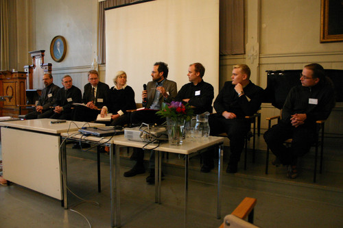
The material for the project’s internal evaluation was collected in two ways. In subproject-specific intermediate and final reports, the administration collected information about the contentual, technical and administrative progress of the project and about possible problems. An evaluation workshop was organised together with the conference in Rome. In the workshop, three work groups, made up of the workers of different subprojects, evaluated the project’s progress on a general level. The results of the groups were examined during a joint evaluation discussion. A memo was written on the discussion. In addition, one of the tasks of the steering group was the follow-up and evaluation of the project’s progress. This report and the actions presented here have been accepted by the steering group. Chapters 6, 7 and 8 are based on the work of the steering group, results of the evaluation workshops and technical reports of the subprojects.
Summary on the contents of the 3D-Bridge project:
| co-organiser | Jyväskylä University Museum | Bibliotheca Hertziana, Max Planck Institute for Art History |
Royal Holloway, University of London, Department of Classics |
Seinäjoki University of Applied Sciences (former Seinäjoki Polytechnic) | Evakko Säätiö Foundation | target area | Seminaarinmäki Campus Jyväskylä, Finland |
Filippo Juvarra's palace and garden plan, 1705, Italy |
Villa architecture at Castelporziano. Archaeological excavations Rome, Italy | St.Trinitatis Church, 1742, Liepaja, Latvia |
Churches, Chapels and Monasteries of Karelia, Republic of Karelia, Russia |
| Idea | Development of Virtual Research Environment, case of Finnish campus as an institutional environment. Visualisation of the 1920's. | Visualisation of the multiperspective space conception | Integration and dissemination of archaeological, architectural and geomorphological data. Analysing and entering this data to the GIS database | Monitoring system of the skeletal structure of a European Late Baroque church | Byzantine-Russian wood architecture and European revival styles in sacral building construction Visualisation of the 1930's |
| tasks 1.9.-2005- 28.2.2006 |
Scanning photos and floor plans. Modelling the buildings, saving the data in digital form in to the a database, software planning |
Gathering of original materials, starting 3D modelling and animation plan drawings, first floor, vaultings and garden plan | Archaeological and geomorphological fieldwork Analysis of the archaeological data and entering it into the GIS database |
Laser scanning of the church in November 2005 Starting to analyse “point cloud data” |
Research of the Finnish Orthodox Church museum, the Finnish Orthodox Church, and New Valamo monastery archives |
| task 1.3. - 30.8.2006 |
Software testing and development Modelling the environments The software was published under a licence of open source, GPL. http://www.arthis.jyu.fi/bridge/jyu.php |
Modelling of the palace project and garden Linking the model to the Lineamenta database and publishing the results on http://www.arthis.jyu.fi/bridge/hertziana.php |
Modelling coastline and architecture. Mapping for potential open source database. http://www.arthis.jyu.fi/bridge/holloway.php |
Processing “point cloud data” for 3D model, The modelling work http://www.arthis.jyu.fi/bridge/seinajoki.php |
Photographing and videotaping Valamo Monastery (March 2006) Modelling of Valamo Monastery Main Church and modelling of Salmi Church http://www.arthis.jyu.fi/bridge/evakko.php |
| Conferences , etc | 3D-Bridge Conference, 10th – 11th November 2005, Jyväskylä, Finland 3D-Bridge Conference, 19th – 21st June 2006, Rome, Italy |
3D-Bridge Conference, 10th – 11th November 2005, Jyväskylä, Finland 3D-Bridge Conference, 19th – 21st June 2006, Rome, Italy |
3D-Bridge Conference, 10th – 11th November 2005, Jyväskylä, Finland 3D-Bridge Conference, 19th – 21st June 2006, Rome, Italy |
3D-Bridge Conference, 10th – 11th November 2005, Jyväskylä, Finland 3D-Bridge Conference, 19th – 21st June 2006, Rome, Italy |
3D-Bridge Conference, 10th – 11th November 2005, Jyväskylä, Finland 3D-Bridge Conference, 19th – 21st June 2006, Rome, Italy |
Project partners
Each of the project’s five organisers has their own regional and national interest groups. The interest groups that participated in the project can be divided into four groups based on their principal task.
- Organisations storing cultural heritage material, such as museums, libraries, restoration institutes and archives.
- Universities, research institutions, universities of applied sciences.
- Companies.
- Project supporters and funders.
In the project plan, the organisations presented in the following table’s column 1 were named as interest groups; the participating organisations have been marked with numbers 1 - 4, which describe the type of collaboration. Column 2 includes collaborative partners that have joined the project since the beginning.
| Planned project partners | New partners that have joined the project |
| Names of partners at local or regional level | |
|
University of Jyväskylä: Faculty of Humanities, Faculty of Information Technology, Senate Properties, Jyväskylä Museum of Central Finland, Jyväskylä Municipal Archives, City of Jyväskylä Jyväskylä Provincial Archives Done Solutions Regional Council of Central Finland |
Cultural committee of the University of Jyväskylä |
| Names of partners at national level | |
|
National Museum of Finland The National Board of Antiquities University of Oulu University of Joensuu Orthodox Church of Finland Orthodox Church Museum, Kuopio Finnish Defense Forces, The Military Archives and The Military Museum National Archive of Finland 27th Jaeger Battalion Heritage Association/Division of South Ostrobothnia City of Seinäjoki Regional Museum of South Ostrobothnia Regional Council of South Ostrobothnia Regional Council of North Savo |
University of Helsinki EVTEK Institute of Art and Design The Art Conservation Institute of Valamo Finnish Road Enterprise, Finland Nordic Geo Center Ltd. |
| Names of partners in other countries eligible for participation in the Culture 2000 programme | |
|
Archivio Storico, Museo d’Arte Contemporanea, Rivoli/Torino (Italy): Kunstbibliothek, Berlin (Germany): Bibliothèque du Ministère de la Guerre, Vincennes (France) Biblioteca Nacional, Madrid (Spain) Evangelical-Lutheran Consistory of Latvia Trinitatis Church (Latvia) City of Liepaja (Latvia) Riga Technical University (Latvia) Archives of Viborg (Russia) Archives of Petrozavodsk (Russia) Archives of St. Petersburg ( Russia) Monasteries of Valamo and Konevitsa, Republic of Karelia (Russia) Professor Helen Rendell, Loughborough University, Loughborough (United Kingdom) Dr Anna Gallina Zevi (III Soprintendente, Soprintendenza archeologica di Ostia), Rome (Italy) |
Accademia Nazionale di San Luca, Rome British School, Rome The Finnish Institute in Rome, Villa Lante, Rome Dr Maria Giuseppina Lauro, Segretariato Generale della Presidenza della Repubblica (Tenuta di Castelporziano) Museo Civico d’Arte Antica e Palazzo Madama, Turin, Italy Sebastian Hohenstein, Munich, (Germany) |
General evaluation of the project
Shared expertise directed at common European cultural heritage was considered important by the participants of the project. Internationality, polyphony of different participants and plenitude of viewpoints created situations in which the participants could learn from one another. This created a need to evaluate one’s own and others’ research and visualisation targets and working methods from new perspectives. Naturally, the difference between collaborative partners was also resource consuming. Work was required right until the end of the project in order to develop a common language and working method for it.
The project’s short period of activity and the fast working pace required by it were considered to be increasing efficiency, but also problematic. This lead to a partial delay in the planned schedule and, for example, the collaboration and interaction of the modelling staff was emphasised during the final stage of the project. The biggest problem was considered to be the plenitude of administrative tasks and the inflexibility of various regulations. It caused a great amount of work, for example, when trying to reconcile the administrative practices of the project’s national participants and the regulations of the Culture 2000 programme. The steering group made an evaluation of the project in its final meeting, according to the funders’ instructions. Realisation of the goals, concerning the three main objectives, was evaluated using the following scale:
1: the project did not obtain results and possibly had to be suspended
2: the project succeeded passably well and its results were passably obtained
3: the project succeeded well in obtaining some of its results
4: the project succeeded well: the results were obtained
5: the project succeeded excellently: the results were obtained and new openings were made, the project continues as normal activity
Determined in this way, the general grade given to the project is 4, which is the average of the grades given by the members of the steering group.
7.Summary and European Added Value
The 3D-Bridge project has produced European added value by aiming at the renewal of the research, recording and presentation forms of physical cultural heritage to new audiences. Based on evaluation discussions in the Rome conference, it can be stated that the three main objectives of the project increased the awareness of the project participants about the common, classical core of European culture and about its continuation through different eras and stylistic periods, as well as over national and religious borders, to the present day.
The main objectives of the project were obtained well. The first objective of the project, which was to develop tools of new technology to foster cultural heritage, was realised in each five subproject in ways that were characteristic of the target areas. (See table 1.) The software application based on open source thinking and the modelling instructions, both developed by the Seminaarinmäki project of the University of Jyväskylä, have been published on the 3D-Bridge website, and they are available to everyone.
The second objective, to bring together the cultural heritage of geographically, culturally and economically different areas, took place most clearly in conference work, as the subprojects presented their own output. As the five visualisations are complete, they form an illustrative, linked entity that can be examined from several perspectives. Visual representation of the models enables representing and illustrating European value basis without the restrictions of spoken or written language. Additionally, four out of five visualisation targets are located in another part of Europe than the creators of the visualisation, which naturally means that the creators have familiarised themselves in-depth with the history and culture of the target area. Thus, international research participates in promoting and directing the process of value formation in Europe.
The third objective, to translate cultural heritage to the languages of future media generations becomes concrete in the different contexts of the 3D visualisations: in teaching, research, tourism and preservation of cultural heritage. Thus, the 3D-Bridge project considers that the material produced during the project serves, in addition to the future contexts of use of the subprojects, the Museum of Europe that will be opened in future.
8. Budget
In the project agreement the budget total was estimated to be 301 400.83 euros. The Commission grant was 49.77% of the total budget estimate to amount to a maximum of 150 000.00 euros.
The financial contributions of the co-organisers were as follows:
-
University of Jyväskylä 46 120.67
Including: Ministry of Education and Culture, Finland 17 000.00
University of Jyväskylä, Department of Art and Culture 17 870.67
University of Jyväskylä, Faculty of Humanities 3 750.00
University of Jyväskylä, Administration 7 500.00 - Bibliotheca Hertziana, Max Planck Institute for Art History 15 070.04
- Royal Holloway, University of London 15 070.04
- Evakko Säätiö 15 070.04
- Seinäjoki University of Applied Sciences (former Seinäjoki Polytechnic) 15 070.04
In addition, the 3D-Bridge project received funding from the following institutions and organisations:
- Regional Council of South Ostrobothnia 15 000.00 max. 5%
- Regional Council of Central Finland 15 000.00
- Regional Council of North Savo 15 000.00
9. Future of 3D-Bridge
The project participants have unanimously stated that the visualisation projects, development of methods and collaboration has to be continued. Especially methodological development work can only be initiated in a one-year project, and applications proceed to their first testing phase. However, various collaboration ideas came up at the Rome conference and the intention is now to work these ideas, together and independently. The utilisation of the results of each subproject has been discussed in detail in chapter 4, Visualisation of Cultural Heritage - Functional Description, Utilisation of the Results.
We find that the material and visualisations produced in the project are suitable material for the Museum of Europe. According to our knowledge, the traditional physical exhibition of the museum will be opened in Brussels in 2007. Thus, we consider that it would increase the availability and interestingness of the European museum from the point of view of future generations, if the museum also functioned as a virtual museum.
The material of our project, considering the cultural heritage it represents, belongs to the collection of built European cultural heritage in the virtual museum. The important challenge of fostering cultural heritage is to solve how digital culture products and documentations can be stored for future use. We hope that the European virtual museum will also consider how the jointly produced, diverse material of cultural heritage can maintain its availability and usability.
This project has been funded with support from the European Commission. This publication reflects the view only of the author, and the Commission cannot be held responsible for any use which may be made of the information contained therein.


